Conservation is entering a new era in which the physical world and the digital world converge. Forests, rivers, coral reefs, wetlands, wildlife corridors, and entire protected areas are now being mirrored in sophisticated virtual environments. These mirrors are not static maps or simple dashboards. They are dynamic digital twins: living replicas that update with real-time data, learn from past behavior, and simulate possible futures. For conservation platforms, digital twins are becoming a foundational technology, changing how scientists monitor ecosystems, how managers allocate limited resources, how policymakers test interventions, and how the public engages with nature.
The rise of digital twins in conservation is timely. Biodiversity loss, climate disruption, pollution, land-use change, and illegal extraction are placing unprecedented pressure on natural systems. Traditional conservation often reacts after damage has occurred. Digital twins allow a shift toward anticipation. They combine satellite imagery, drone surveys, acoustic sensors, camera traps, weather stations, hydrological gauges, genetic sampling, and human observations into a single, evolving model. The result is a platform that can detect change, explain causes, forecast risks, and recommend actions before a crisis becomes irreversible.
This article explores how digital twins are transforming conservation platforms. It examines the technology stack, data sources, practical applications, benefits, challenges, governance questions, and future trajectories. It also outlines how organizations can build and sustain a conservation digital twin platform that is scientifically credible, ethically responsible, and economically viable.
What Exactly Is a Digital Twin?
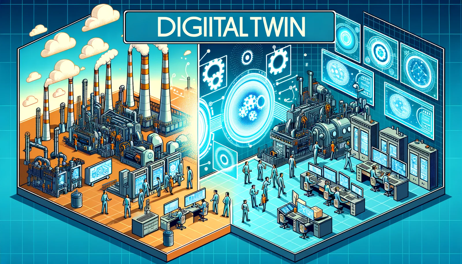
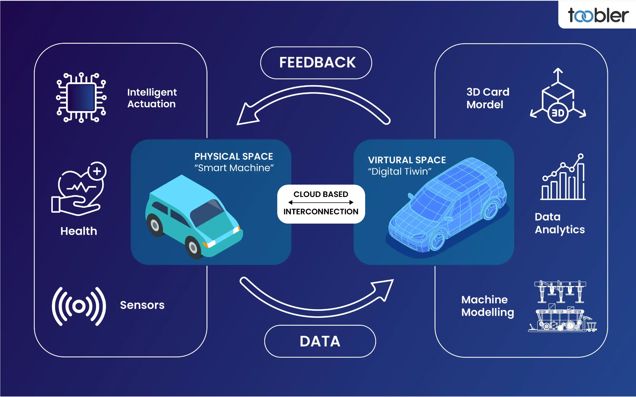
A digital twin is a virtual representation of a physical system that is connected to its real-world counterpart through data. The connection can be continuous, near-real-time, or periodic, depending on the sensors and infrastructure available. A digital twin typically includes four elements: a physical asset or ecosystem, a digital model, a data link, and a set of services that use the model to support decisions.
In conservation, the “asset” may be a national park, a watershed, a migratory route, a mangrove forest, a fishery, or a single endangered species. The digital model may be ecological, hydrological, atmospheric, behavioral, or economic. The data link may rely on satellites, 5G, LoRaWAN, Wi-Fi, or store-and-forward devices. The services may include alerts, scenario planning, compliance monitoring, restoration design, and community reporting.
Unlike a conventional simulation, a digital twin is not a one-time exercise. It evolves. When rainfall increases in a catchment, the twin updates its hydrology. When a camera trap detects a rare predator, the twin updates species distribution estimates. When a restoration team plants seedlings, the twin records the intervention and predicts survival rates. This continuous feedback loop is what makes digital twins so powerful for conservation platforms.
Why Conservation Platforms Need Digital Twins
Conservation platforms face a fundamental problem: nature is complex, data is fragmented, and decisions are urgent. A single protected area may generate information from rangers, satellites, drones, sensors, local communities, researchers, and government agencies. Without integration, these data streams remain isolated. Digital twins provide a shared operational picture.
They also help address four persistent gaps:
A. The knowledge gap, where data exists but is not translated into usable insight.
B. The prediction gap, where managers lack tools to forecast ecological change.
C. The coordination gap, where agencies, NGOs, communities, and funders work from different information.
D. The accountability gap, where interventions are difficult to track and evaluate.
By closing these gaps, digital twins transform conservation from a reactive discipline into a proactive, evidence-driven practice. They allow platforms to ask “what if” questions safely and cheaply in the virtual world before applying them in the real world.
Core Architecture of a Conservation Digital Twin Platform
A robust conservation digital twin platform is built on several layers. Each layer must be designed for interoperability, scalability, and long-term maintenance.
A. Sensor layer. This includes camera traps, acoustic recorders, weather stations, water-quality probes, soil moisture sensors, GPS collars, drones, and satellite constellations. These devices collect raw observations from the field.
B. Connectivity layer. Data must travel from remote ecosystems to computing environments. This layer may use satellite uplinks, cellular networks, LoRaWAN, mesh radio, or edge gateways. In deep forests or oceans, connectivity is often the hardest challenge.
C. Data ingestion and storage layer. The platform needs data lakes, warehouses, and geospatial databases that can handle structured and unstructured data. Time-series data, images, audio, video, LiDAR point clouds, and genetic sequences must be stored with metadata and version control.
D. Modeling and simulation layer. This is the analytical heart of the twin. It may include hydrological models, species distribution models, agent-based models, climate projections, fire spread simulations, and ecosystem service valuations.
E. Artificial intelligence and machine learning layer. AI classifies images, detects gunshots or chainsaws, predicts poaching risk, identifies whale calls, forecasts algal blooms, and optimizes patrol routes. Machine learning also helps fill data gaps and quantify uncertainty.
F. Visualization and interaction layer. Maps, 3D scenes, dashboards, virtual reality, and mobile apps make the twin accessible. A ranger may see a real-time alert on a phone, while a policymaker explores long-term scenarios on a large screen.
G. Decision-support layer. The platform translates model outputs into recommended actions, trade-off analyses, and prioritization scores. It may suggest where to restore mangroves, where to deploy patrols, or how to adjust water releases from a dam.
H. Governance and security layer. Data ownership, access control, privacy, cybersecurity, and ethical safeguards must be embedded from the start. Conservation data can be sensitive, especially when it reveals the location of endangered species or vulnerable communities.
Data Sources That Power the Twin
A digital twin is only as good as its data. Conservation platforms are increasingly combining multiple data sources to create a rich, multi-dimensional view.
A. Satellite remote sensing provides land cover, vegetation indices, sea surface temperature, chlorophyll concentrations, and thermal anomalies. Satellites can detect deforestation, drought stress, and coral bleaching over vast areas.
B. Drones and airborne LiDAR capture fine-scale topography, canopy structure, biomass, and floodplain geometry. They are especially useful for mapping restoration sites and verifying carbon projects.
C. Camera traps and acoustic sensors generate millions of images and sound recordings. AI models can identify species, count individuals, and detect human activity such as vehicles or gunshots.
D. Environmental DNA and genomic tools reveal species presence from water, soil, or air samples. This is transforming biodiversity monitoring, especially for rare or cryptic species.
E. Animal-borne sensors, including GPS collars and bio-loggers, track movement, behavior, heart rate, and energy expenditure. These data help design wildlife corridors and reduce human-wildlife conflict.
F. Weather and climate stations provide local meteorological data that feed hydrological and fire models. Radar and satellite precipitation estimates fill gaps in remote regions.
G. Hydrological and oceanographic sensors measure river flow, water quality, salinity, currents, and wave energy. These are essential for wetland, fishery, and coastal conservation.
H. Socio-economic and community data include land tenure, resource use, livelihoods, and local ecological knowledge. When collected ethically, these data make the twin more inclusive and realistic.
I. Historical records, museum collections, and paleoecological data provide baselines. They help distinguish natural variability from human-driven change.
How Digital Twins Change Conservation Workflows
Digital twins do not simply add a new tool. They reshape workflows across the conservation cycle.
A. Monitoring becomes continuous and multi-scale. Instead of occasional surveys, platforms receive ongoing signals from sensors and satellites. Anomalies trigger alerts, and analysts can zoom from a continent to a single tree.
B. Prediction becomes operational. Fire risk, flood risk, disease outbreaks, and poaching hotspots can be forecast days, weeks, or months ahead. This allows pre-positioning of resources and early community warnings.
C. Scenario planning becomes collaborative. Stakeholders can compare alternative futures: strict protection versus community-managed use, dam construction versus removal, reforestation with native species versus monoculture plantations. The twin shows likely ecological and social outcomes.
D. Adaptive management becomes faster. When a strategy underperforms, the twin helps diagnose why. Managers can adjust actions and observe results in near-real-time.
E. Enforcement becomes smarter. Patrol routes can be optimized using predictive models. Evidence from cameras, acoustics, and satellite alerts can support investigations and legal cases.
F. Restoration becomes more precise. The twin can identify where seedlings are most likely to survive, which species mix will be resilient, and how hydrology must be restored.
G. Stakeholder engagement becomes immersive. Virtual tours, interactive maps, and scenario games help communities, donors, and students understand conservation trade-offs.
Real-World Applications and Emerging Cases
Digital twins are being applied across terrestrial, freshwater, marine, and urban conservation.
In forest conservation, platforms use satellite alerts, drone imagery, and acoustic sensors to detect illegal logging. A digital twin can simulate how roads, fires, and climate change will fragment habitat. It can also verify carbon sequestration and biodiversity co-benefits for results-based finance.
In marine conservation, digital twins of coral reefs combine temperature data, water quality, fish surveys, and hydrodynamic models. Managers can test coral restoration designs, predict bleaching events, and plan marine protected areas that account for larval dispersal.
In freshwater systems, river basin twins integrate rainfall, snowmelt, groundwater, dams, and irrigation withdrawals. They help balance human water needs with environmental flows for fish, birds, and wetlands.
In wildlife conservation, digital twins track endangered species and their habitats. They can model disease transmission, genetic connectivity, and the impact of climate-driven range shifts. They also support anti-poaching operations by predicting where threats are most likely.
In urban conservation, cities use digital twins to plan green infrastructure, reduce heat islands, manage stormwater, and protect urban biodiversity. These twins connect parks, rivers, and rooftops into ecological networks.
In agricultural landscapes, digital twins help design agroforestry systems, reduce pesticide runoff, and monitor soil health. They can align food production with conservation goals.
Benefits for Conservation Platforms and Stakeholders
The benefits of digital twins extend far beyond scientific research.
A. Real-time awareness. Managers see what is happening now, not what happened last year.
B. Predictive intelligence. Platforms anticipate threats and opportunities instead of reacting.
C. Scenario testing. Decision-makers compare options before committing funds and political capital.
D. Resource optimization. Patrols, restoration crews, and sensors are deployed where they matter most.
E. Transparency. Donors and citizens can see evidence of impact and learn from failures.
F. Collaboration. Shared models and data reduce duplication and build trust across organizations.
G. Funding opportunities. Digital twins support carbon markets, biodiversity credits, payments for ecosystem services, and ESG reporting.
H. Education and outreach. Interactive twins inspire students, visitors, and local communities.
I. Policy support. Governments can use twins for land-use planning, disaster risk reduction, and international reporting.
J. Resilience. Ecosystems and communities are better prepared for climate shocks and ecological surprises.
Challenges and Risk Management
Digital twins are not a silver bullet. They introduce technical, financial, and ethical challenges.
A. Data gaps. Many ecosystems lack baseline data, especially in the Global South. Models may be uncertain where data is sparse.
B. Interoperability. Different sensors, databases, and models often use incompatible formats and standards.
C. Compute and energy costs. High-resolution simulations and AI training require significant computing power and electricity.
D. Model uncertainty. Ecological systems are nonlinear and unpredictable. Twins must communicate uncertainty clearly.
E. Privacy and security. Data on species locations, community lands, and patrol movements can be misused.
F. Equity and access. If only wealthy organizations can build twins, conservation priorities may be skewed.
G. Maintenance. Sensors break, batteries die, software ages, and staff change. Long-term funding is essential.
H. Capacity building. Managers need training to interpret models and use dashboards effectively.
I. Legal and regulatory issues. Data ownership, cross-border data flows, and liability for decisions require clear rules.
J. Over-reliance on technology. Local knowledge and field experience remain irreplaceable. Twins should augment, not replace, human judgment.
Building a Conservation Digital Twin Platform: A Practical Roadmap
A successful platform follows a phased approach. It starts with a clear problem, not with technology.
A. Define the purpose and scope. Identify the specific conservation question, decision, or threat. Choose a manageable geographic and thematic boundary.
B. Map stakeholders and data needs. Engage governments, communities, researchers, NGOs, and funders. Determine who will use the twin and for what decisions.
C. Audit existing data and infrastructure. Inventory sensors, databases, models, and connectivity. Identify gaps and prioritize data collection.
D. Design the architecture. Choose standards, platforms, and cloud or edge computing strategies. Build for interoperability and security from day one.
E. Develop the minimum viable twin. Start with a few key data streams and one or two models. Demonstrate value quickly and iterate.
F. Validate and calibrate. Compare model outputs with field observations. Involve independent experts and local knowledge holders.
G. Deploy decision-support tools. Create dashboards, alerts, and reports tailored to different users.
H. Train and support users. Provide ongoing training, documentation, and help desks.
I. Monitor impact and improve. Track whether the twin changes decisions and outcomes. Adapt the platform as needs evolve.
J. Scale and sustain. Develop business models, partnerships, and governance structures for long-term operation.
AI, IoT, and Edge Computing in Conservation Twins
Artificial intelligence is accelerating digital twin capabilities. Computer vision identifies species in camera trap images faster than human teams. Natural language processing scans news reports and social media for illegal wildlife trade. Reinforcement learning optimizes patrol routes and restoration schedules. Generative AI can create synthetic data to fill gaps, though it must be used carefully.
The Internet of Things provides the nervous system. Low-power sensors, solar-powered gateways, and satellite IoT networks connect remote areas. Edge computing processes data locally, reducing bandwidth and latency. A camera trap can run an AI model on-device and send only an alert when a poacher or rare animal is detected. This saves energy and protects sensitive data.
Together, AI, IoT, and edge computing make digital twins more responsive, affordable, and scalable. They also raise new questions about bias, transparency, and accountability. Platforms must document how algorithms are trained and tested.
Governance, Ethics, and Community Participation
Conservation digital twins are not neutral. They reflect the values, priorities, and power dynamics of those who build them. Ethical governance is essential.
A. Data sovereignty. Communities should control data about their lands, resources, and knowledge.
B. Free, prior, and informed consent. Research and monitoring must respect community rights and decision-making processes.
C. Benefit sharing. Local people should share in the economic and social benefits of digital twins.
D. Transparency. Algorithms, models, and assumptions should be explainable to affected stakeholders.
E. Bias prevention. Training data and model design must avoid marginalizing certain species, places, or people.
F. Security. Sensitive location data must be encrypted and access-controlled.
G. Accountability. There should be clear responsibility for decisions made with the twin.
H. Inclusivity. Platforms should support local languages, low-bandwidth access, and diverse user needs.
The Future of Digital Twins in Conservation
The next decade will see digital twins become more interconnected, intelligent, and accessible. We can expect:
A. A global biodiversity twin that links national and regional platforms.
B. Real-time coupling of climate, ocean, land, and socio-economic models.
C. Generative AI assistants that help managers explore scenarios in plain language.
D. Digital twins of individual species, ecosystems, and even entire biomes.
E. Integration with biodiversity credits, carbon markets, and natural capital accounting.
F. Virtual reality and metaverse experiences that bring nature to global audiences.
G. Quantum computing for complex ecological optimization.
H. Autonomous drones and robots that act on twin recommendations.
I. Community-led twins that put local knowledge at the center.
J. Open standards and shared data commons that reduce duplication and increase trust.
Conclusion

Digital twins are transforming conservation platforms from static information systems into dynamic, predictive, and participatory engines for action. They help scientists understand complexity, managers make better decisions, policymakers design smarter rules, and communities defend their territories. They also create new opportunities for funding, education, and global collaboration.
Yet technology alone cannot save biodiversity. Digital twins must be grounded in strong science, ethical governance, and respect for local rights. They must be maintained, funded, and adapted over time. When built wisely, they become more than virtual replicas. They become instruments of stewardship, helping humanity care for the living world with greater foresight, fairness, and effectiveness.